Lahaina, Maui - Wildfire Satellite Images Before vs. After
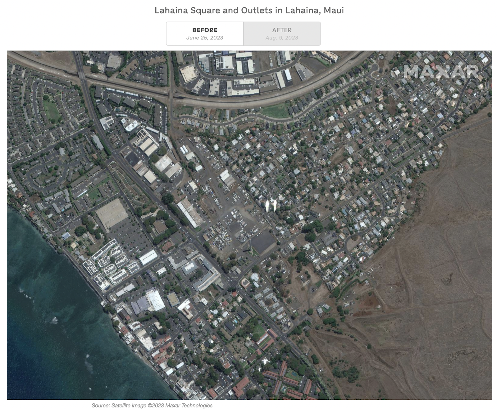
Aren Gonzales The first image taken on June 25, 2022 of Lahaina Square and Outlets, illustrates the land before the wildfires destroyed the community. Due to the square plots of green vegetation, high reflectivity of buildings, and light brown soil, it can be concluded that Lahaina was untouched by fire destruction. Lahaina received deadly wildfires on the same day the second image was captured. The imagery is important because it portrays all of the homes that were taken by this fire, and the density of black smoke. Even so, the air in this image is shown as hazy. At least 97 residents perished from this catastrophic event. Even so, families resorted to jumping in the ocean for refuge. This devastating occurrence resulted in civilians losing pets, homes, businesses, and valuables. The magnitude of Lahaina's wildfire made it a deadly disaster. https://www.npr.org/sections/pictureshow/2023/08/10/1193138605/satellite-images-show-utter-devastation-from-wildfires-in-maui ...